


KARABI-YAYLA
Crimea, Ukraine
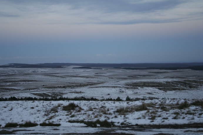
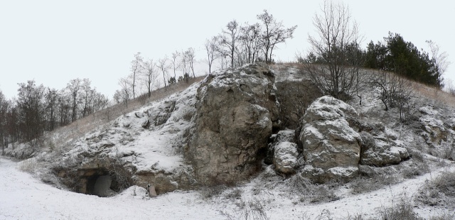
The panorama of Karabi-Yayla. Photo by Vidmantas Balkūnas
Karabi-Yayla is the largest karst plateau in Crimea: it's area extends up to 113 km2 (about 11 km from west to east and about 10 km from north to south). The region consists of two levels: the upper level - the mountain ridge of Karatau (1260 m), - and the lower level - the Karabi itself (600-1000 m).
The massif consists of karst rock - limestone. The proper climate conditions led to formation of more than 250 caves. Two of the three deepest caves of Ukraine (Nakhimovskaya and Soldatskaya) are situated on Karabi-Yayla. In 1989 Karabi-Yayla was announced a Crimea mountain karst reservation.
It is always windy here and the weather is extremely changeable. The fog of Karabi creates the atmosphere worth of the Bermudian triangle. You will find no water, nor settlements on Karabi-Yayla. The only point of civilization is the former meteorological station that gives shelter to the cavers now. There is only a post of lifeguard (to be exact - only one inhabitant) left on the station.
Lithuanian cavers organize expeditions to the caves of Crimea for many years. We even have several Lithuanian caves discovered by Raimondas Daniūnas - the oldest are Venta and Sezam (discovered more than 20 years ago).
The cave cadastre of Crimea
Descriptions and schemes of some caves of Crimea
The photos of the expeditions of 2009 to Karabi-Yayla: Raimondas Daniūnas' cave exploration seminar: 1st part (April/May), 2nd part (June/July), 3rd part (August/September), 4th part (October/November); Cave rescue courses (May); Speleoschool expedition (June); Courses of the 2nd level speleopreparation (July); Meeting of the New Year (December/January 2010).
The photos of the expeditions of 2008 to Karabi-Yayla: Easter celebration (March); Cave search (April/May); Cave search (June/July); New Year (December/January 2009).
The photos of the expeditions of 2007 to Karabi-Yayla: Soldatskaya (April/May) ; Sezam (July) ; Sezam (August) ; Sezam (October) ; Sezam (October/November)
The photos of the expeditions of 2006 to Karabi-Yayla and Ay-Petri
The photos of expedition to Karabi Yayla in 2005
The photos of expedition to Karabi Yayla in 2001
The photos of expedition to Karabi Yayla in 2000
The photos of expedition to Karabi Yayla in 1996
Venta
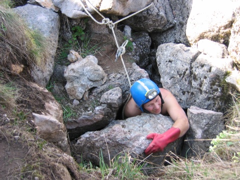
The entrance into the cave Venta and the discoverer of the cave - Raimondas Daniūnas. Photo by Julius Šidiškis
Depth: -215 m (sometimes -190 m)
Length: 800 m
Discovered in 1983.
The scheme of Venta (2009, by Odessian caving club)
Technical description and the scheme for rigging the cave (2009; in Lithuanian)
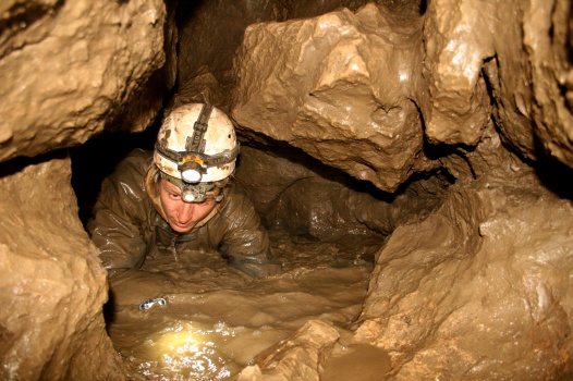
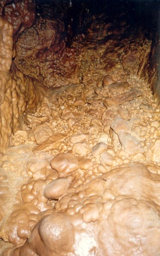 In the cave Venta
From the narration of Raimondas: "Venta is the river that flows not only across Lithuania, it also crosses Latvia. Maybe that is why Latvians, who participated in the expedition, agreed to give this name to the cave so easily. This cave leads you down to the depth of 190 m or maybe more, but only in respect for the cave of Gvozdetsky (-191 m) we haven't wrote the larger depth..."
Though there are no magnificent halls, a variety of stalactites or stalagmites in this cave and it is wet and muddy, the cave's walls, hallways, passages and wells are of curious shape. The cave Venta is mysterious and fascinates by its challenges, surprises and versatile obstacles. It surrenders to the cavers unwillingly, little by little, and opens up and lets you enter only as much as you have earned to. The cave conforms to the category of difficulty 2A.
Sezam
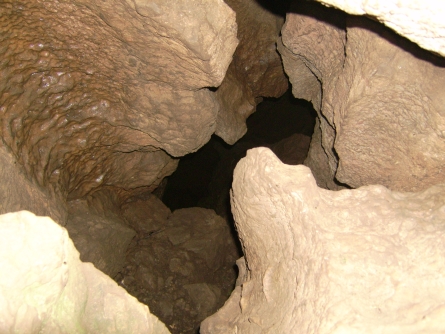
Sezam. Photo by Aleksandr Kesmedji
Depth: -206 m (and it‘s still not the bottom, the exploration goes on)
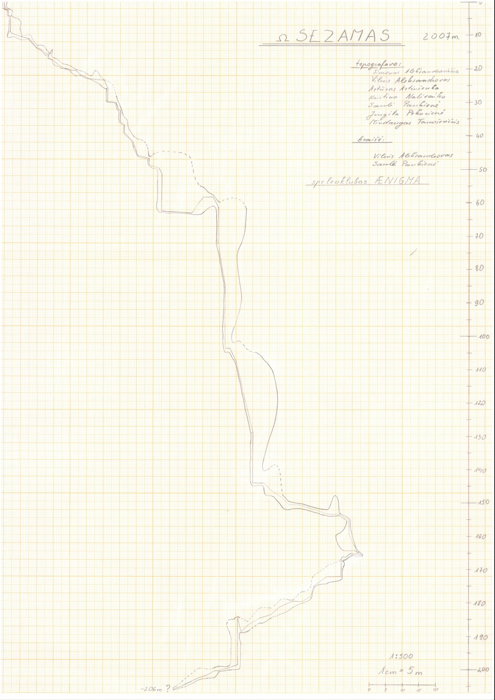
The plan and the profile of the cave made in 2007 and proportionated to the results of hydro-levelling
The cave Sezam was discovered in 1986 by Raimondas Daniūnas. That year the cave was passed until The Old Bottom. The next year an extremely narrow meander called Rūbinė (The Cloak-Room) was discovered. It ended up with a pitch of 78 m deep. The cave was considered to be -150 m (measured by hydro-levelling) until the July 2006 expedition lead by Raimondas Daniūnas. After a break of 20 years in explorations the cave became deeper by 20 m and longer by 50 m. In October 2006 during another expedition the narrowest parts of the cave were widened and now almost everyone can reach the Fake Bottom. In 2007 Lithuanian cavers were still very interested in this cave: four of five expeditions held in this year to Karabi-Yayla explored the Sezam. During two of these expeditions the topography and hydro-levelling of the cave were made. Nevertheless the bottom of the Sezam is still not reached. So the next tasks in this cave are exploration and widening of new galleries. A window in the Big Pitch also needs to be checked.
The photos of expedition to Sezam in June/July 2006
The photos of expedition to Sezam in October 2006
The photos of expedition to Sezam in July 2007
The photos of expedition to Sezam in August 2007
The photos of expedition to Sezam in October 2007
The photos of expedition to Sezam in November 2007
Soldatskaya
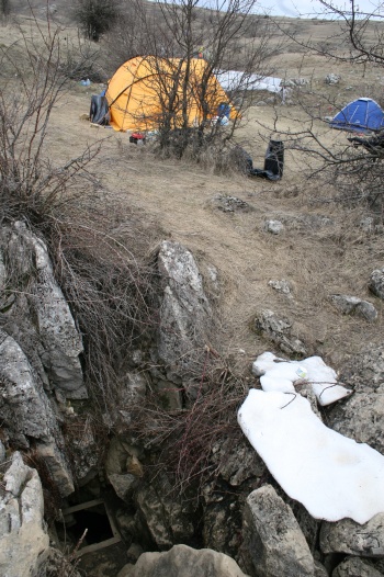
The entrance into the cave Soldatskaya. Photo by Vidmantas Balkūnas
Soldatskaya is the deepest and the most difficult cave of Ukraine. In 2007 the team of "Aenigma" organized an expedition aiming to get the skills, necessary for work in a cave of such difficulty. The bottom of the cave was reached, most participants of the expedition gained very valuable experience.
One of the countless meanders of Soldatskaya. Photo by Vidmantas Balkūnas
Depth: -517 m
Length: 2100 m
Category of difficulty: 4B
The scheme of the cave Soldatskaya
Technical description and the scheme for rigging the cave (in Russian; taken from the report of 2004 expedition of Moscow caving club Barrier)
Description of the cave Soldatskaya (in Russian)
------------------------------------------------------------------------------------------------------------------------------------------------------
THE DISTRICT OF TERNOPOL
West Ukraine
Mlynki
The entrance into the cave Mlynki. Photo by Tomas Bikelis
The cave Mlynki is a horizontal labyrinth gypsum cave. The total length of cave branches is over 27 kilometers.
The plan of the cave Mlynki
Cave scheme of Ternopol's district
Cave cadastre of Ternopol's district
The photos of expedition to the horizontal caves of west Ukraine in 2006/2007
The photos of the expedition to the horizontal cave Optimistitcheskaya (length - 220 km) in the Carpatian Mountains in 2006
The photos of expedition to the horizontal caves of west Ukraine in 2006
The photos of the spring expedition to the horizontal cave Optimistitcheskaya in 1998